At the forefront of this technology, we leverage John Deere RTK Mobile, a cellular signal-based system that delivers highly accurate GNSS positioning with a repeatability of +/- 1 inch, year after year. But what does this precision mean for your operation, and how does it benefit you in the long run? Let’s explore.
- Unmatched Accuracy for Complex Fields
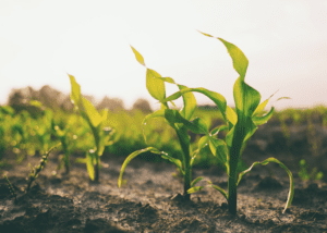
Fields are rarely uniform; many have unique internal features like **waterways, terraces**, or varying topographies that require precise boundary management. RTK technology ensures that your field boundaries are mapped with pinpoint accuracy, down to an inch. This level of precision is critical when you’re dealing with intricate layouts, as even minor discrepancies can lead to inefficiencies in planting, spraying, and harvesting operations.
With John Deere RTK Mobile, you get consistent accuracy season after season. This repeatability allows you to return to the exact same boundaries year after year, maintaining optimal planting rows, avoiding overlaps, and reducing wasted inputs like seeds and fertilizers.
- Instant Data Uploads and Accessibility
One of the standout features of our RTK solution is the ability to instantly upload field boundaries to the MyJohnDeere System. Once your boundaries are mapped, they are seamlessly transferred to the cloud, where they can be accessed from any device. This streamlined process eliminates the hassle of manually transferring data and ensures that you can start working with your boundaries immediately.
By having your boundaries stored in the MyJohnDeere System, they can be shared effortlessly across your entire fleet of John Deere equipment. This integration means that your tractors, planters, sprayers, and harvesters are always operating within the precise field boundaries, leading to more efficient and accurate work.
- Seamless Integration with Other GPS Systems
If you’re using equipment from other manufacturers, there’s no need to worry. Our system allows for exporting shapefiles, which can be easily integrated into any GPS system. Whether you’re working with another brand of equipment or collaborating with other operators, the flexibility of shapefile exports ensures that you can maintain the same high standards of accuracy across your entire operation.
- Efficiency Gains Across Operations
The precision provided by RTK field boundaries translates directly into efficiency gains across all aspects of your operation. When your equipment operates within tightly defined and accurate boundaries, you reduce overlap and minimize missed sections in planting, spraying, and harvesting. This not only improves input efficiency but also enhances crop yield by ensuring every inch of your field is utilized effectively.
Additionally, having precisely mapped boundaries helps with tasks like drainage planning, irrigation management, and soil sampling. You can execute fieldwork with confidence, knowing that you’re operating within the correct parameters, avoiding unnecessary adjustments and rework
- Cost Savings and Environmental Benefits
Precise boundaries reduce input costs by minimizing overlaps and optimizing application rates for seeds, fertilizers, and pesticides. This means you’re only applying what’s needed, where it’s needed. Over time, this leads to significant cost savings, but the benefits don’t stop there.
By using fewer resources, you’re also reducing your environmental footprint. Precision in your field boundaries ensures that inputs aren’t over-applied or wasted, helping you contribute to more sustainable farming practices.
Conclusion: Future-Proof Your Farm with RTK Precision
The combination of John Deere RTK Mobile’s high-accuracy positioning and its seamless integration into the MyJohnDeere System offers a powerful tool for modern farming. Whether you’re managing fields with intricate internal features or seeking to boost operational efficiency, RTK field boundaries provide the precision, repeatability, and flexibility you need.
Ready to streamline your field operations with RTK precision? Contact us today to learn more about how our solutions can help you take control of your field boundaries and maximize your productivity.