SoilOptix® is a one-of-a-kind, premium top soil analysis system that sets the standard for accuracy and precision in agriculture; a value-added layer that fits into the everyday management decisions growers make on their fields.
Most Data Points Per Field Available
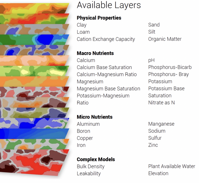
Over 25 Property Layers available
Optimize Inputs, Maximize Yields
Soil mapping results to make the most informed on-farm decisions
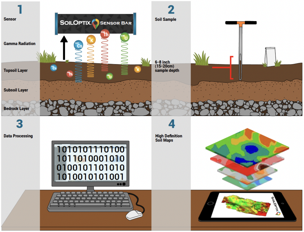
How Soil Mapping Works
SoilOptix® uses a non-contact, pre-calibrated sensor that measures natural geological properties. Standard field practice: – Sensor mounted 2 ft (60 cm) above ground – 12 mph (20 kph) maximum field speeds – 40 ft (12 m) swath widths
Strategically placed soil samples are taken once every 8 acres (3.2 ha) & sent to your local lab for analysis. Results are integrated into our final product.
SoilOptix® then intakes, analyzes, & processes the information using proprietary software & algorithms. Data processing is completed within a target of 48 business hours.
High-definition nutrient & texture maps are returned to you in generic SHP or CSV files. Files are VRA-ready & can be easily integrated into most data platforms; including Climate FieldView & John Deere Operations Centre.
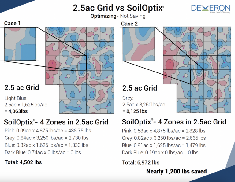
Soil Mapping Case Study
Make Deveron your trusted Soil Mapping and SoilOptix® provider